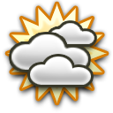
| Rest of tonight |
Monday (20 Apr) |
Monday night |
Tuesday (21 Apr) |
Tuesday night |
Wednesday (22 Apr) |
Wednesday night |
 |
 |
 |
 |
|
|
 |
| Snow Cold! |
Partly Cloudy | Partly Cloudy Cold! |
Mostly Cloudy | Partly Cloudy | Partly Cloudy | Clear |
| <2 mm (10%) | - | - | <2 mm (20%) | <2 mm (30%) | - | - |
| Lo: -1°C | Hi: 8°C | Lo: 0°C | Hi: 14°C | Lo: 5°C | Hi: 18°C | Lo: 4°C |
 10 km/h WNW |
 13 km/h NW |
 6 km/h NNE |
 18 km/h S |
8 km/h S |
8 km/h NNE |
 6 km/h N |
| Rest of tonight | Partly cloudy. A slight chance of snow. Cold. Low -1°. Wind chill ranging from -5 to 0. Wind west-northwest around 10 kph, gusting to 29 kph. Chance of precipitation less than 20 percent. Precipitation (liquid equivalent) mostly less than 2 mm. Little or no snow accumulation expected. Minimum freezing level 0 meters above sea level. Minimum snow level -150 meters above sea level. |
| Monday (20 Apr) | Partly cloudy in the morning, becoming partly to mostly cloudy in the afternoon. High 8°. Wind northwest around 13 kph, gusting to 30 kph. Maximum freezing level 900 meters above sea level. |
| Monday night | Mostly clear in the evening, becoming fair to partly cloudy after midnight. Cold. Low 0°. Wind chill ranging from -3 to 7. Wind north-northeast around 6 kph in the evening, becoming south after midnight. Minimum freezing level 200 meters above sea level. |
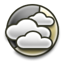
| Tuesday (21 Apr) | Mostly cloudy in the morning, becoming mostly cloudy to cloudy in the afternoon. A slight chance of rain in the afternoon. Breezy. High 14°. Wind south around 18 kph, gusting to 34 kph. Chance of precipitation 20 percent. Precipitation mostly less than 2 mm. Maximum freezing level 2450 meters above sea level. Maximum snow level 1950 meters above sea level. |
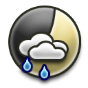
| Tuesday night | Mostly cloudy to cloudy in the evening, becoming partly cloudy after midnight. A chance of rain. Low 5°. Wind south around 8 kph, gusting to 27 kph, in the evening, becoming north-northeast after midnight. Chance of precipitation 30 percent. Precipitation mostly less than 2 mm. Minimum freezing level 2450 meters above sea level. Minimum snow level 2300 meters above sea level. |
| Wednesday (22 Apr) | Partly cloudy in the morning, becoming mostly sunny in the afternoon. Mild. High 18°. Wind north-northeast around 8 kph in the morning, becoming southeast in the afternoon. Maximum freezing level 2900 meters above sea level. |
| Wednesday night | Clear. Low 4°. Wind north around 6 kph. Minimum freezing level 2900 meters above sea level. |
| Thursday (23 Apr) | Sunny in the morning, becoming partly cloudy in the afternoon. Mild. High 19°. UV index up to 6. Wind northeast around 6 kph in the morning, becoming east-southeast in the afternoon. Maximum freezing level 3100 meters above sea level. |
 | Thursday night | Mostly cloudy in the evening, becoming cloudy after midnight. Low 7°. Wind northeast around 6 kph in the evening, becoming 13 kph, gusting to 28 kph, after midnight. Minimum freezing level 3100 meters above sea level. |
| Friday (24 Apr) | Cloudy. High 16°. Wind northeast around 17 kph, gusting to 32 kph, in the morning, becoming east in the afternoon. Maximum freezing level 3200 meters above sea level. |
 | Friday night | Cloudy in the evening, becoming dense overcast after midnight. A slight chance of rain in the evening, then a chance of rain after midnight. Breezy. Low 8°. Wind east around 15 kph, gusting to 30 kph, in the evening, becoming 23 kph, gusting to 38 kph, after midnight. Chance of precipitation 60 percent. Precipitation mostly around 5 mm. Minimum freezing level 3050 meters above sea level. Minimum snow level 2300 meters above sea level. |
 | Saturday (25 Apr) | Dense overcast. Rain likely in the morning, then a chance of rain in the afternoon. Windy. High 12°. Wind east around 29 kph, gusting to 45 kph. Chance of precipitation 80 percent. Precipitation mostly around 10 mm. Maximum freezing level 3050 meters above sea level. |
| Saturday night | Dense overcast in the evening, becoming cloudy after midnight. A chance of rain. Breezy. Low 9°. Wind east around 19 kph, gusting to 37 kph. Chance of precipitation 30 percent. Precipitation mostly less than 2 mm. Minimum freezing level 2150 meters above sea level. Minimum snow level 1800 meters above sea level. |
 | Sunday (26 Apr) | Dense overcast. A chance of rain. Breezy. High 13°. Wind east-northeast around 19 kph, gusting to 34 kph. Chance of precipitation 30 percent. Precipitation mostly less than 2 mm. Maximum freezing level 2400 meters above sea level. Maximum snow level 2300 meters above sea level. |
| Sunday night | Cloudy. A slight chance of rain. Low 9°. Wind east-northeast around 11 kph, gusting to 26 kph. Chance of precipitation 20 percent. Precipitation mostly less than 2 mm. Minimum freezing level 2300 meters above sea level. Minimum snow level 2200 meters above sea level. |
Monday 20 April 2026
 06:25 EDT 06:25 EDT
 20:06 EDT Daylength: 13:41 20:06 EDT Daylength: 13:41
| ||||||||
| Period | Forecast | Temperature | Wind | Precipitation | Pressure | UV | ||
| Morning 06 - 12 |
 |
Mostly clear - Mostly cloudy | -1°C - 5°C | |
17 km/h Gust up to 30 km/h 3 Bft Gentle breeze |
- | 1027 hPa |  Medium (2.5) |
| Afternoon 12 - 18 |
|
Partly cloudy | 4°C - 8°C | |
8 - 13 km/h Gust up to 27 km/h 3 Bft Gentle breeze |
- | 1027 hPa | Medium (3.1) |
| Evening 18 - 00 |
|
Mostly clear | 8°C - 2°C |   |
2 - 8 km/h Gust up to 20 km/h 2 Bft Light breeze |
- | 1027 hPa | - |
|
Tuesday 21 April 2026
06:24 EDT
20:07 EDT Daylength: 13:44
| ||||||||
| Period | Forecast | Temperature | Wind | Precipitation | Pressure | UV | ||
| Night 00 - 06 |
|
Partly cloudy | 2°C |  |
3 - 13 km/h Gust up to 23 km/h 3 Bft Gentle breeze |
- | 1026 hPa | - |
| Morning 06 - 12 |
 |
Cloudy Drizzle |
0°C - 9°C | |
14 - 20 km/h Gust up to 34 km/h 3 Bft Gentle breeze |
- | 1023 hPa | Medium (2.6) |
| Afternoon 12 - 18 |
|
Mostly cloudy Drizzle |
9°C - 14°C | |
14 - 21 km/h Gust up to 34 km/h 4 Bft Moderate breeze |
0.6 mm | 1018 hPa | Medium (3.3) |
| Evening 18 - 00 |
 |
Mostly cloudy Drizzle - Light rain |
13°C - 8°C | |
5 - 12 km/h Gust up to 24 km/h 2 Bft Light breeze |
0.29 mm | 1015 hPa | - |
|
Wednesday 22 April 2026
06:22 EDT
20:09 EDT Daylength: 13:46
| ||||||||
| Period | Forecast | Temperature | Wind | Precipitation | Pressure | UV | ||
| Night 00 - 06 |
|
Partly cloudy - Mostly clear | 7°C | |
6 - 10 km/h Gust up to 14 km/h 2 Bft Light breeze |
0.64 mm | 1014 hPa | - |
| Morning 06 - 12 |
|
Mostly cloudy | 5°C - 14°C | |
7 - 12 km/h Gust up to 19 km/h 2 Bft Light breeze |
- | 1016 hPa |  Medium (4) |
| Afternoon 12 - 18 |
|
Partly cloudy - Clear | 15°C - 18°C |  |
7 km/h Gust up to 18 km/h 1 Bft Light air |
- | 1016 hPa |  Medium (5.3) |
| Evening 18 - 00 |
|
Clear | 17°C - 7°C | |
8 km/h Gust up to 19 km/h 2 Bft Light breeze |
- | 1017 hPa | - |
|
Thursday 23 April 2026
06:21 EDT
20:10 EDT Daylength: 13:49
| ||||||||
| Period | Forecast | Temperature | Wind | Precipitation | Pressure | UV | ||
| Night 00 - 06 |
|
Clear | 7°C - 4°C | |
7 km/h Gust up to 12 km/h 1 Bft Light air |
- | 1018 hPa | - |
| Morning 06 - 12 |
|
Clear | 4°C - 17°C |  |
4 - 10 km/h Gust up to 23 km/h 2 Bft Light breeze |
- | 1019 hPa | Medium (5.3) |
| Afternoon 12 - 18 |
|
Mostly clear - Cloudy | 19°C |  |
7 km/h Gust up to 20 km/h 1 Bft Light air |
- | 1017 hPa |  High (5.9) |
| Evening 18 - 00 |
 |
Mostly cloudy | 16°C - 9°C | |
7 km/h Gust up to 18 km/h 1 Bft Light air |
- | 1016 hPa | - |
|
Friday 24 April 2026
06:19 EDT
20:11 EDT Daylength: 13:52
| ||||||||
| Period | Forecast | Temperature | Wind | Precipitation | Pressure | UV | ||
| Night 00 - 06 |
|
Cloudy | 8°C | |
8 - 19 km/h Gust up to 28 km/h 3 Bft Gentle breeze |
- | 1015 hPa | - |
| Morning 06 - 12 |
|
Overcast - Cloudy | 7°C - 12°C | |
19 km/h Gust up to 32 km/h 3 Bft Gentle breeze |
- | 1016 hPa | Medium (3.2) |
| Afternoon 12 - 18 |
|
Cloudy Drizzle |
12°C - 16°C | |
18 km/h Gust up to 32 km/h 3 Bft Gentle breeze |
- | 1013 hPa | Medium (3.7) |
| Evening 18 - 00 |
|
Cloudy - Overcast Light rain |
14°C - 10°C | |
13 - 19 km/h Gust up to 30 km/h 3 Bft Gentle breeze |
0.74 mm | 1011 hPa | - |
|
Saturday 25 April 2026
06:18 EDT
20:12 EDT Daylength: 13:55
| ||||||||
| Period | Forecast | Temperature | Wind | Precipitation | Pressure | UV | ||
| Night 00 - 06 |
 |
Overcast Moderate rain - Chance drizzle |
9°C | |
22 - 26 km/h Gust up to 38 km/h 4 Bft Moderate breeze |
4.05 mm | 1009 hPa | - |
| Morning 06 - 12 |
 |
Overcast Chance drizzle - Light rain |
8°C - 11°C | |
26 - 32 km/h Gust up to 45 km/h 5 Bft Fresh breeze | 9.1 mm | 1009 hPa |  Low (1.2) |
| Afternoon 12 - 18 |
|
Overcast Light rain |
9°C - 12°C | |
24 - 32 km/h Gust up to 46 km/h 5 Bft Fresh breeze | 2.42 mm | 1010 hPa |  Low (1.5) |
| Evening 18 - 00 |
|
Overcast - Cloudy Drizzle |
11°C | |
18 - 22 km/h Gust up to 35 km/h 4 Bft Moderate breeze |
0.69 mm | 1011 hPa | - |
|
Sunday 26 April 2026
06:16 EDT
20:13 EDT Daylength: 13:57
| ||||||||
| Period | Forecast | Temperature | Wind | Precipitation | Pressure | UV | ||
| Night 00 - 06 |
 |
Cloudy - Overcast Drizzle - Light fog |
10°C |  |
20 km/h Gust up to 32 km/h 3 Bft Gentle breeze |
0.2 mm | 1011 hPa | - |
| Morning 06 - 12 |
|
Overcast Drizzle |
11°C | |
22 km/h Gust up to 34 km/h 4 Bft Moderate breeze |
0.5 mm | 1012 hPa | Low (1.8) |
| Afternoon 12 - 18 |
|
Overcast - Cloudy Drizzle |
10°C - 13°C | |
13 - 20 km/h Gust up to 33 km/h 3 Bft Gentle breeze |
0.09 mm | 1013 hPa | Low (2.2) |
| Evening 18 - 00 |
|
Cloudy Drizzle - Light rain |
12°C | |
8 - 14 km/h Gust up to 26 km/h 3 Bft Gentle breeze |
0.1 mm | 1015 hPa | - |
|
Monday 27 April 2026
06:15 EDT
20:15 EDT Daylength: 13:60
| ||||||||
| Period | Forecast | Temperature | Wind | Precipitation | Pressure | UV | ||
| Night 00 - 03 |
|
Cloudy Drizzle |
9°C | |
12 km/h Gust up to 21 km/h 2 Bft Light breeze |
0.51 mm | 1016 hPa | - |
|
Monday 20 April 2026
06:25 EDT
20:06 EDT Daylength: 13:41
| |||||||||||
| Period | Forecast | Temperature | Wind | Precipitation | Lightning | Dewpoint | Pressure | Humidity | UV | Clouds | Zicht |
| 04 - 05 | Partly cloudy |
-0.5°C (Feels like: -5°C) |
15.2 km/h NW 3 Bft Gentle breeze |
0.27 mm | - | -6.0°C | 1023.3 hPa | 66 % | - | 38 % | 21.2 km |
| 05 - 06 | Partly cloudy |
-0.8°C (Feels like: -5°C) |
14.7 km/h NW 3 Bft Gentle breeze |
- | - | -6.1°C | 1024.0 hPa | 67 % | - | 31 % | 22.0 km |
| 06 - 07 | Mostly clear |
-0.7°C (Feels like: -5°C) |
14.6 km/h NW 3 Bft Gentle breeze |
- | - | -6.1°C | 1025.1 hPa | 67 % | - | 23 % | 22.7 km |
| 07 - 08 | Mostly clear |
0.5°C (Feels like: -4°C) |
15.0 km/h NW 3 Bft Gentle breeze |
- | - | -6.1°C | 1026.3 hPa | 61 % | - | 23 % | 23.2 km |
| 08 - 09 | Partly cloudy |
1.3°C (Feels like: -3°C) |
15.7 km/h NW 3 Bft Gentle breeze |
- | - | -6.1°C | 1026.9 hPa | 57 % | Low (0.5) |
46 % | 23.6 km |
| 09 - 10 | Mostly cloudy |
2.3°C (Feels like: -2°C) |
16.1 km/h NW 3 Bft Gentle breeze |
- | - | -6.1°C | 1027.4 hPa | 54 % | Low (1.1) |
70 % | 24.0 km |
| 10 - 11 | Cloudy |
2.9°C (Feels like: -1°C) |
16.1 km/h NW 3 Bft Gentle breeze |
- | - | -6.2°C | 1027.7 hPa | 51 % | Low (1.6) |
86 % | 24.3 km |
| 11 - 12 | Mostly cloudy |
3.8°C (Feels like: 0°C) |
14.4 km/h NW 3 Bft Gentle breeze |
- | - | -6.2°C | 1027.8 hPa | 48 % | Medium (2.5) |
76 % | 24.5 km |
| 12 - 13 | Mostly cloudy |
4.8°C (Feels like: 2°C) |
12.9 km/h NW 2 Bft Light breeze |
- | - | -6.1°C | 1027.6 hPa | 45 % | Medium (3.1) |
67 % | 24.6 km |
| 13 - 14 | Mostly cloudy |
5.7°C (Feels like: 3°C) |
11.4 km/h NW 2 Bft Light breeze |
- | - | -6.1°C | 1027.2 hPa | 42 % | Medium (3.1) |
59 % | 24.7 km |
| 14 - 15 | Mostly cloudy |
6.4°C (Feels like: 4°C) |
10.6 km/h NW 2 Bft Light breeze |
- | - | -6.1°C | 1026.7 hPa | 40 % | Medium (2.6) |
56 % | 24.7 km |
| 15 - 16 | Partly cloudy |
7.1°C (Feels like: 5°C) |
9.7 km/h NW 2 Bft Light breeze |
- | - | -6.0°C | 1026.5 hPa | 39 % | Low (1.8) |
52 % | 24.6 km |
| 16 - 17 | Partly cloudy |
7.6°C (Feels like: 6°C) |
8.5 km/h NW 2 Bft Light breeze |
- | - | -6.0°C | 1026.7 hPa | 37 % | Low (0.9) |
46 % | 24.5 km |
| 17 - 18 | Partly cloudy |
8.0°C | 8.2 km/h NW 2 Bft Light breeze |
- | - | -5.9°C | 1026.7 hPa | 37 % | - | 34 % | 24.4 km |
| 18 - 19 | Mostly clear |
8.0°C | 7.3 km/h NE 1 Bft Light air |
- | - | -5.8°C | 1026.9 hPa | 37 % | - | 22 % | 24.2 km |
| 19 - 20 | Clear |
7.1°C | 5.9 km/h NE 1 Bft Light air |
- | - | -5.7°C | 1026.9 hPa | 40 % | - | 13 % | 24.0 km |
| 20 - 21 | Clear |
5.8°C | 4.8 km/h NE 1 Bft Light air |
- | - | -5.6°C | 1027.2 hPa | 44 % | - | 13 % | 23.6 km |
| 21 - 22 | Clear |
4.5°C | 3.8 km/h North 1 Bft Light air |
- | - | -5.4°C | 1027.4 hPa | 49 % | - | 13 % | 23.2 km |
| 22 - 23 | Clear |
3.4°C | 2.9 km/h North 1 Bft Light air |
- | - | -5.2°C | 1027.5 hPa | 53 % | - | 16 % | 22.8 km |
| 23 - 00 | Mostly clear |
2.3°C | 3.2 km/h North 1 Bft Light air |
- | - | -5.0°C | 1027.1 hPa | 58 % | - | 30 % | 22.5 km |
|
Tuesday 21 April 2026
06:24 EDT
20:07 EDT Daylength: 13:44
| |||||||||||
| Period | Forecast | Temperature | Wind | Precipitation | Lightning | Dewpoint | Pressure | Humidity | UV | Clouds | Zicht |
| 00 - 01 | Partly cloudy |
1.7°C | 3.8 km/h South 1 Bft Light air |
- | - | -4.7°C | 1026.9 hPa | 62 % | - | 44 % | 22.2 km |
| 01 - 02 | Partly cloudy |
1.1°C | 4.5 km/h South 1 Bft Light air |
- | - | -4.5°C | 1026.6 hPa | 66 % | - | 53 % | 22.1 km |
| 02 - 03 | Partly cloudy |
0.8°C (Feels like: -1°C) |
6.6 km/h South 1 Bft Light air |
- | - | -4.2°C | 1026.5 hPa | 69 % | - | 50 % | 22.0 km |
| 03 - 04 | Partly cloudy |
0.6°C (Feels like: -2°C) |
8.7 km/h South 2 Bft Light breeze |
- | - | -4.1°C | 1026.4 hPa | 71 % | - | 48 % | 22.1 km |
| 04 - 05 | Partly cloudy |
0.5°C (Feels like: -3°C) |
10.9 km/h South 2 Bft Light breeze |
- | - | -3.9°C | 1026.2 hPa | 72 % | - | 49 % | 22.3 km |
| 05 - 06 | Partly cloudy |
0.5°C (Feels like: -3°C) |
12.7 km/h South 2 Bft Light breeze |
- | - | -3.8°C | 1025.4 hPa | 73 % | - | 56 % | 22.5 km |
| 06 - 07 | Mostly cloudy |
0.8°C (Feels like: -3°C) |
14.9 km/h South 3 Bft Gentle breeze |
- | - | -3.6°C | 1024.8 hPa | 72 % | - | 66 % | 22.8 km |
| 07 - 08 | Mostly cloudy |
2.1°C (Feels like: -2°C) |
17.2 km/h South 3 Bft Gentle breeze |
- | - | -3.4°C | 1024.5 hPa | 67 % | - | 76 % | 23.1 km |
| 08 - 09 | Mostly cloudy |
3.8°C (Feels like: -0°C) |
17.9 km/h South 3 Bft Gentle breeze |
- | - | -3.1°C | 1023.9 hPa | 61 % | Low (0.6) |
85 % | 23.3 km |
| 09 - 10 | Mostly cloudy |
5.5°C (Feels like: 2°C) |
18.5 km/h South 3 Bft Gentle breeze |
- | - | -2.9°C | 1023.3 hPa | 55 % | Low (1.4) |
92 % | 23.5 km |
| 10 - 11 | Cloudy |
7.2°C (Feels like: 4°C) |
19.1 km/h South 3 Bft Gentle breeze |
- | - | -2.8°C | 1022.4 hPa | 49 % | Low (2.2) |
97 % | 23.7 km |
| 11 - 12 | Cloudy Drizzle |
8.8°C (Feels like: 6°C) |
19.6 km/h South 3 Bft Gentle breeze |
- | - | -2.7°C | 1021.5 hPa | 44 % | Medium (2.6) |
97 % | 18.9 km |
| 12 - 13 | Cloudy |
9.2°C (Feels like: 7°C) |
19.8 km/h South 3 Bft Gentle breeze |
0.39 mm | - | -1.4°C | 1020.3 hPa | 47 % | Medium (3.3) |
95 % | 23.9 km |
| 13 - 14 | Cloudy |
10.4°C (Feels like: 8°C) |
20.1 km/h South 3 Bft Gentle breeze |
- | - | -1.3°C | 1018.9 hPa | 44 % | Medium (3) |
95 % | 23.8 km |
| 14 - 15 | Cloudy Drizzle |
11.5°C (Feels like: 9°C) |
18.9 km/h South 3 Bft Gentle breeze |
- | - | -1.2°C | 1017.6 hPa | 41 % | Medium (2.6) |
89 % | 20.6 km |
| 15 - 16 | Mostly cloudy |
12.0°C (Feels like: 10°C) |
17.3 km/h South 3 Bft Gentle breeze |
0.21 mm | - | -0.2°C | 1016.6 hPa | 43 % | Low (2) |
83 % | 23.6 km |
| 16 - 17 | Mostly cloudy |
12.8°C (Feels like: 11°C) |
15.9 km/h South 3 Bft Gentle breeze |
- | - | -0.2°C | 1016.0 hPa | 41 % | Low (1) |
81 % | 23.4 km |
| 17 - 18 | Mostly cloudy |
13.1°C | 14.0 km/h South 3 Bft Gentle breeze |
- | 8% | -0.1°C | 1015.6 hPa | 40 % | - | 86 % | 23.2 km |
| 18 - 19 | Cloudy |
12.5°C | 11.8 km/h South 2 Bft Light breeze |
- | 14% | 0.0°C | 1015.3 hPa | 42 % | - | 92 % | 22.9 km |
| 19 - 20 | Cloudy |
11.5°C | 9.6 km/h South 2 Bft Light breeze |
- | 11% | 0.3°C | 1015.0 hPa | 46 % | - | 94 % | 22.5 km |
| 20 - 21 | Cloudy Drizzle |
10.4°C | 8.3 km/h South 2 Bft Light breeze |
- | 9% | 0.5°C | 1014.8 hPa | 50 % | - | 90 % | 18.5 km |
| 21 - 22 | Mostly cloudy |
9.2°C | 6.9 km/h South 1 Bft Light air |
0.29 mm | 7% | 1.5°C | 1014.4 hPa | 59 % | - | 84 % | 21.5 km |
| 22 - 23 | Mostly cloudy |
8.7°C | 5.8 km/h South 1 Bft Light air |
- | 7% | 1.7°C | 1014.0 hPa | 62 % | - | 77 % | 21.0 km |
| 23 - 00 |  Mostly cloudy Light rain |
8.1°C | 5.9 km/h South 1 Bft Light air |
- | 7% | 1.9°C | 1013.6 hPa | 65 % | - | 66 % | 15.2 km |
|
Wednesday 22 April 2026
06:22 EDT
20:09 EDT Daylength: 13:46
| |||||||||||
| Period | Forecast | Temperature | Wind | Precipitation | Lightning | Dewpoint | Pressure | Humidity | UV | Clouds | Zicht |
| 00 - 01 | Partly cloudy |
7.0°C | 6.1 km/h NNE 1 Bft Light air |
0.64 mm | - | 2.8°C | 1013.3 hPa | 75 % | - | 53 % | 20.1 km |
| 01 - 02 | Partly cloudy |
6.7°C | 6.4 km/h NNE 1 Bft Light air |
- | - | 2.7°C | 1013.0 hPa | 76 % | - | 41 % | 19.8 km |
| 02 - 03 | Partly cloudy |
6.3°C | 7.5 km/h NNE 2 Bft Light breeze |
- | - | 2.5°C | 1013.4 hPa | 77 % | - | 34 % | 19.7 km |
| 03 - 04 | Partly cloudy |
5.9°C (Feels like: 4°C) |
8.6 km/h NNE 2 Bft Light breeze |
- | - | 2.4°C | 1013.6 hPa | 78 % | - | 28 % | 19.6 km |